October
November
December
page 8 / 10Mixed Layer Depth ComparisonsThe carbon model requires mixed layer depth (MLD) as an input variable. It is essential that the best estimation of MLD be used as input. These pages describe the rationale for selection of a final input set for processing. SODA ComparisonThe SODA model is given at 0.5 degree resolution (half way between the resolution of the OTIS and the high res models) and it is a data assimilation model. The soda model extends from before 1997 through the end of 2004, and covers the time when the OTIS model was used, and overlaps with the first three months of the NCODA values. There is no overlap with the high res model. The original site for SODA can be seen here.
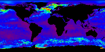
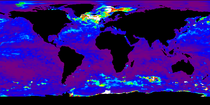
The most important question regarding the the SODA mld values is how well does it compare with the NCODA/TOPS ild data? While it extends for only three months, this comparison is shown below. "White" in the SODA mld plots represents areas where the values are deeper than 400 meters (400 is the max possible in the NCODA/TOPS ild maps). For this comparison, it will do to just consider "white" to be "reddish brown" when you look at them. When we compared NCODA and the high res model, we saw three areas of interest in the Southern Ocean: the deep layer west of South America, the deep layer south of Australia, and the mid-depth layer south of Africa (which NCODA shows as deep, not mid depth; the high res model showed mid-depth results there). What we see here is the deep layer south of Australia, and a mid-depth layer south of Africa (both good). The high to the west of South America, however, appears to be shifted westward with respect to NCODA. Lastly, the mld values in the North Atlantic appear to be a bit deeper than that given by NCODA/TOPS ild.
|
|
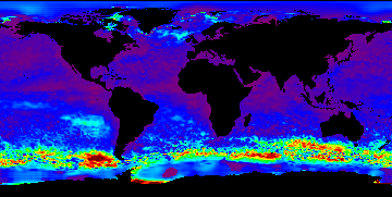
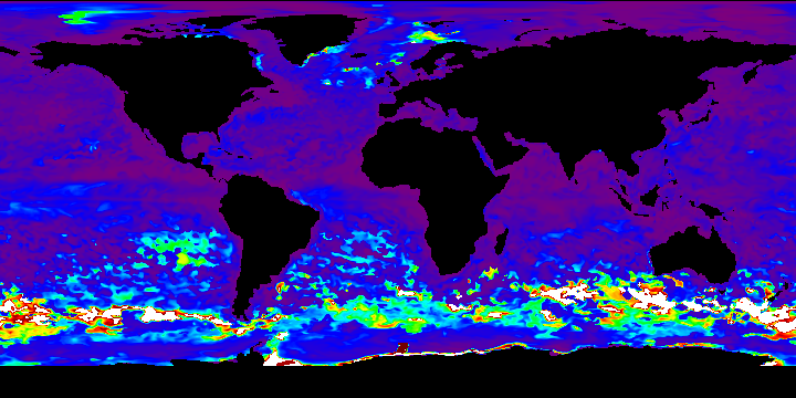
2004
October
|
NCODA/TOPS ild
|
SODA mld
|
|
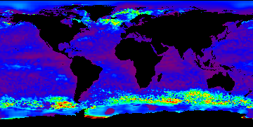
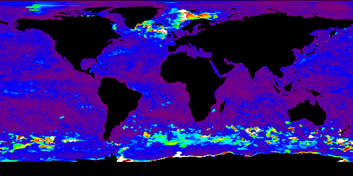
2004
November
|
NCODA/TOPS ild
|
SODA mld
|
|
2004
December
|
NCODA/TOPS ild
|
SODA mld
|
last updated: November 15, 2006