June
July
August
September
October
November
December
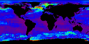
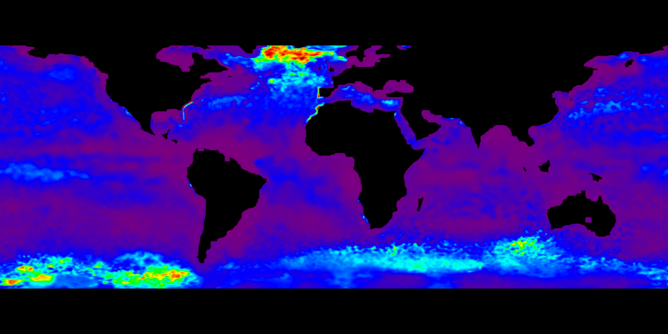
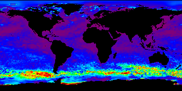
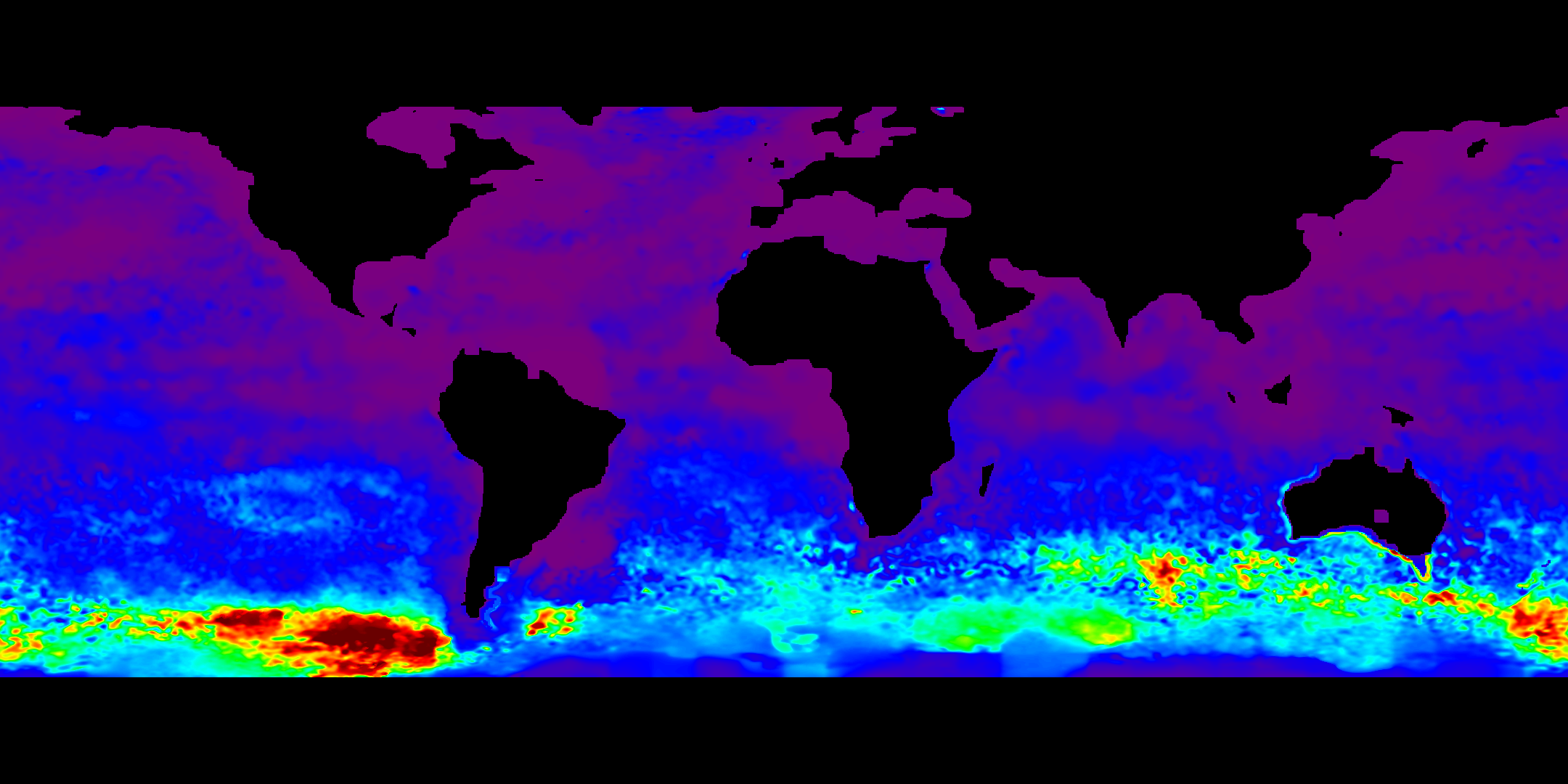
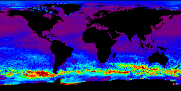
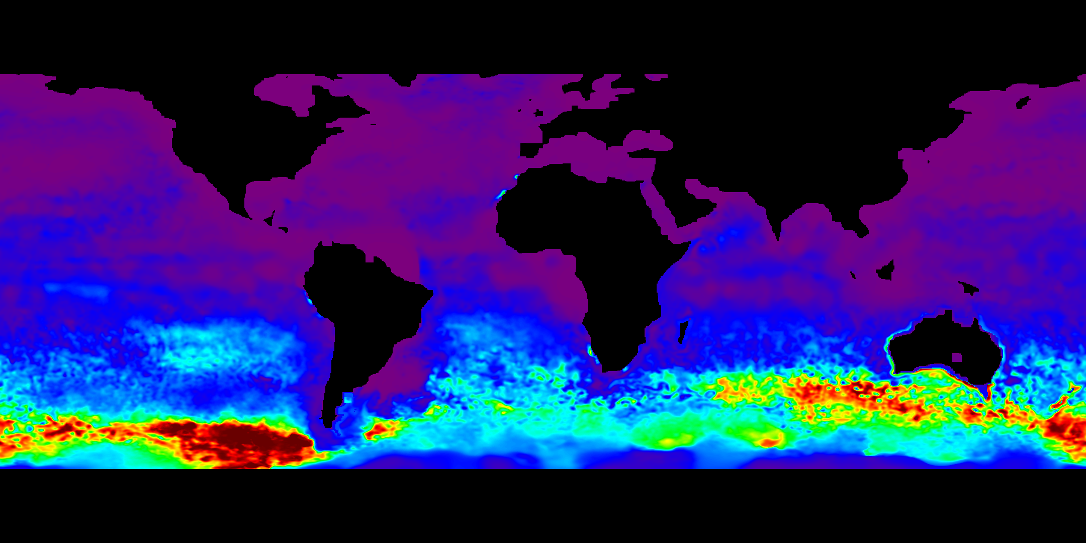
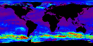
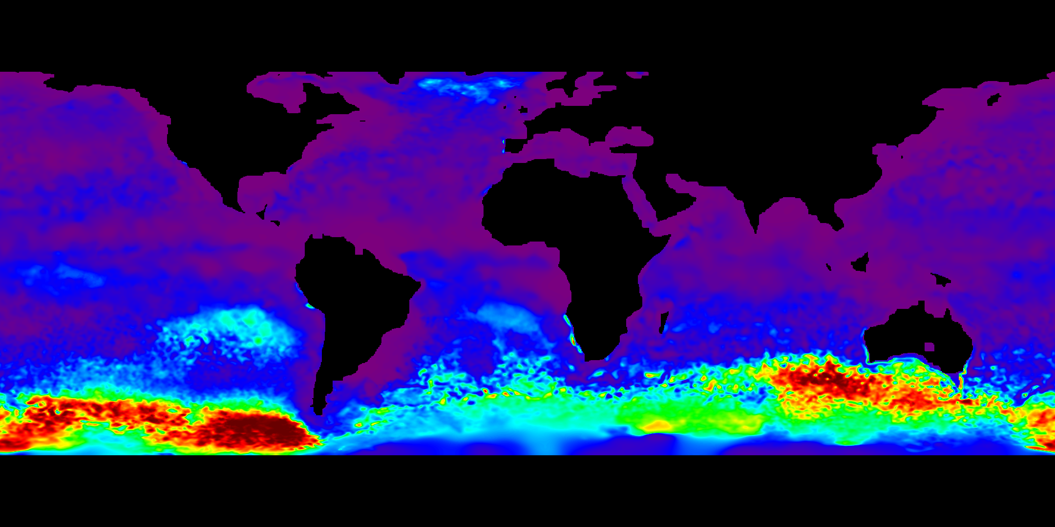
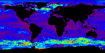
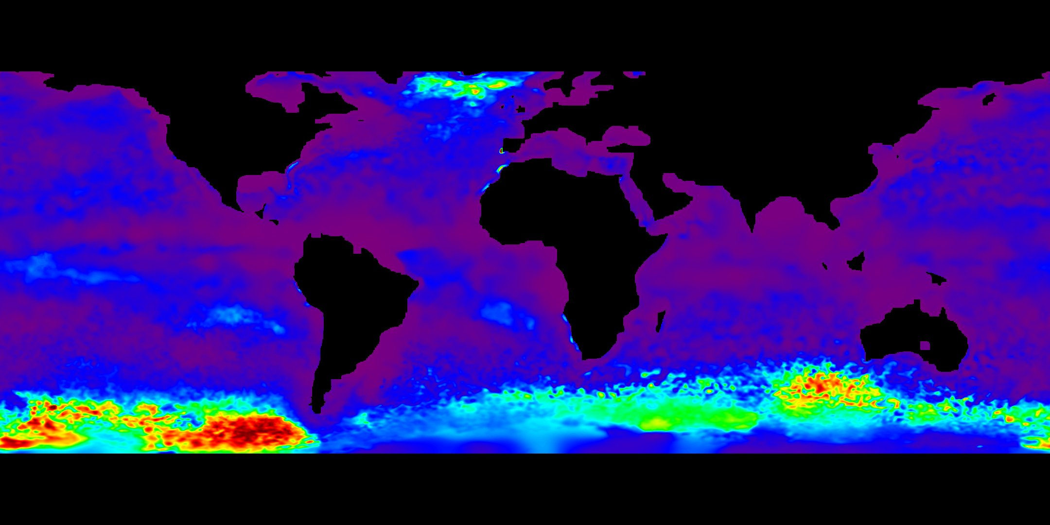
page 6 / 10Mixed Layer Depth ComparisonsThe carbon model requires mixed layer depth (MLD) as an input variable. It is essential that the best estimation of MLD be used as input. These pages describe the rationale for selection of a final input set for processing. FNMOC High Res MLD Values and Comparison with NCODA/TOPS ILD ValuesIn June of 2005, FNMOC began to contribute a high resolution ocean analysis to the Global Ocean Data Assimilation Experiment (GODAE). Instead of working with 1 degree grids (360x181), these maps have 0.25 degree resolution (1441x701 for their coverage area). The haline circulation model has definitely improved, giving coherent mld estimates on a daily basis. Using these daily ocean model files to calculate mld estimates in 2005 allows for comparison with the NCODA/TOPS ild maps for the same time periods. These comparisons are shown below. What is seen is that the Southern Ocean mld deep layers to the west of South America and the deep layers to the south of Australia are found in both the high res data and in the NCODA/TOPS ild files; the ild data has an additional deep layer appearing to the south of Africa, which is not found in the high res mld maps.
|
|
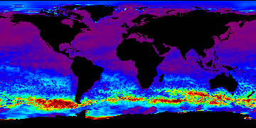
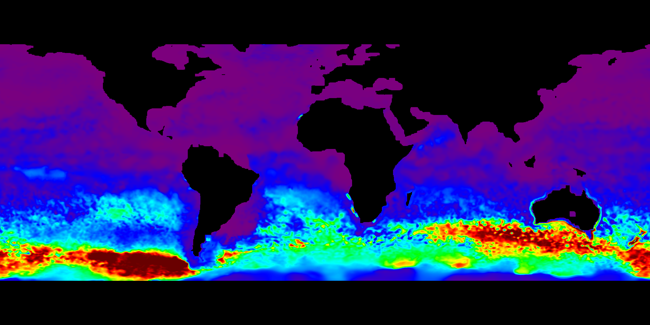
2005
June
|
NCODA/TOPS ild
|
FNMOC high res mld
|
|
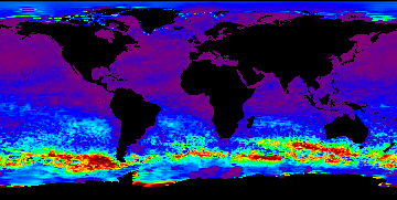
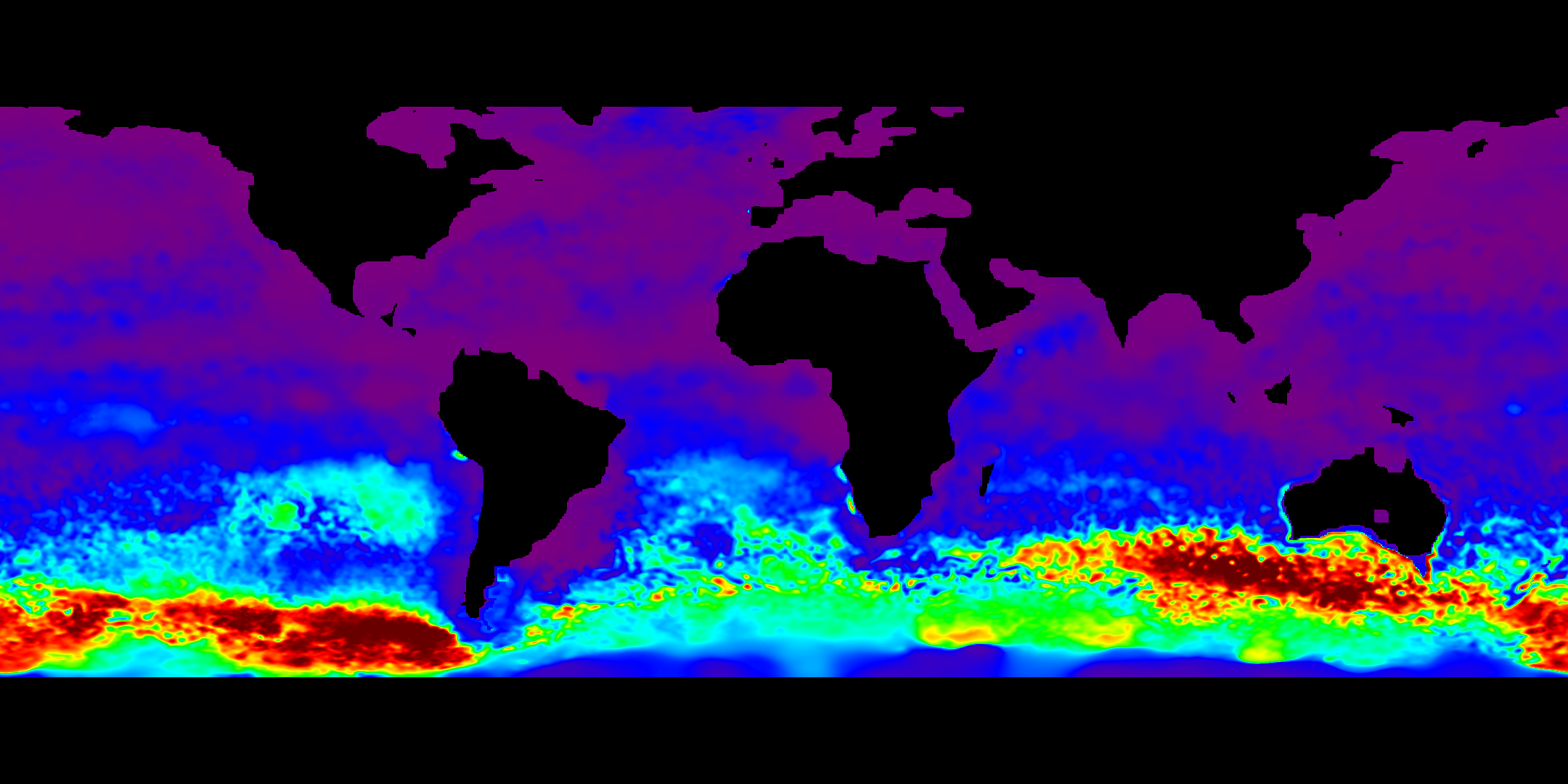
2005
July
|
NCODA/TOPS ild
|
FNMOC high res mld
|
|
2005
August
|
NCODA/TOPS ild
|
FNMOC high res mld
|
|
2005
September
|
NCODA/TOPS ild
|
FNMOC high res mld
|
|
2005
October
|
NCODA/TOPS ild
|
FNMOC high res mld
|
|
2005
November
|
NCODA/TOPS ild
|
FNMOC high res mld
|
|
2005
December
|
NCODA/TOPS ild
|
FNMOC high res mld
|
last updated: November 15, 2006